Switching Google Maps' Measurement Unit: Miles to Kilometers

Learn how to easily switch between miles and kilometers on Google Maps Discover how to view the map scale and change the units on Windows, Mac, and mobile devices Master the art of navigating with accurate distance measurements
Some Noticeable Information
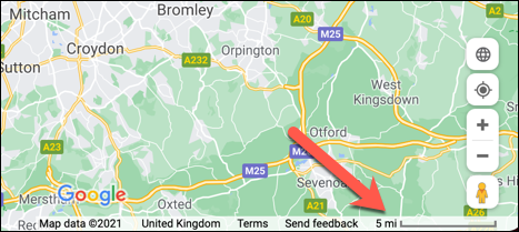
In the desktop web browser, the scale is displayed in the bottom-right corner of the map view, showing either miles or kilometers.
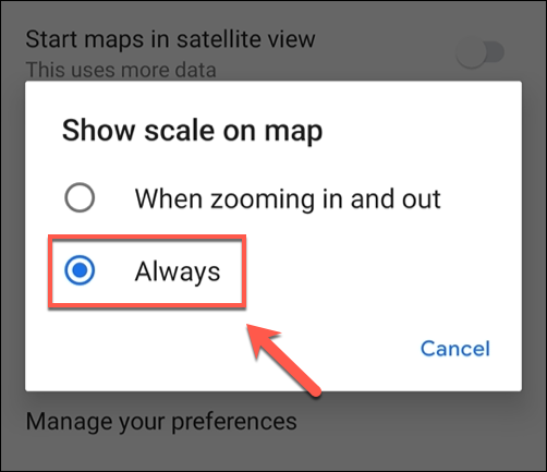
To view the map scale on the Google Maps app, simply zoom in or out. If you want the scale to be constantly displayed, follow these steps: Go to Settings, select Show Scale on Map, and then choose the option "Always."
How to View the Map Scale in Google Maps
To determine the scale of Google Maps, simply check the bottom-right corner of the map view on your desktop web browser. There, you will find a ruler bar indicating the current scale, measured in either miles or kilometers (or smaller units).
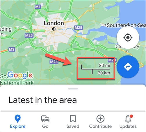
When using the Google Maps mobile app, the scale is typically visible while zooming in or out of the map view, showcasing measurements in both miles and kilometers (or smaller units). Nevertheless, it is possible to customize the display to always show the scale.
How to Change Map Scale Units in Google Maps on Windows or Mac
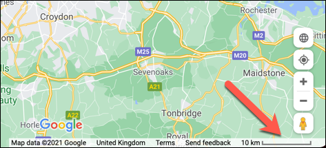
By default, Google Maps displays distance in miles for users in the United States and the United Kingdom, while it shows kilometers for users in Europe. To switch between metric and imperial units on the Google Maps desktop website, simply click on the scale bar located at the bottom-right corner.
By clicking on the scale bar, you can easily switch between different measurements to get a clear understanding of the map scale. This feature enables you to view the scale in miles, kilometers, or other smaller units that are relevant to your needs. For instance, if you are zoomed in on your house, the units will be displayed in feet or meters instead of miles.
How to Always View the Map Scale in Google Maps on Mobile Devices
For users of the Google Maps app on Android, iPhone, or iPad, the map scale is visible exclusively during the zooming process. This scale bar conveniently displays measurements in both kilometers and miles, eliminating the need for users to manually switch between the two units.
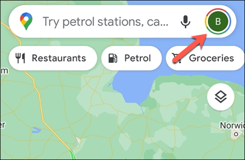
To ensure constant visibility of the map scale, configure the Google Maps application accordingly. Commence by selecting the user profile icon located in the upper-right corner of the app, positioned adjacent to the search bar.
In the pop-up menu, tap the "Settings" option.
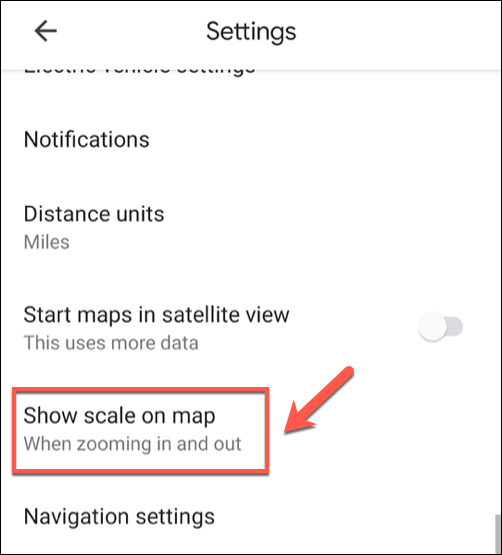
In the "Settings" menu, select the "Show Scale On Map" option.
By default, the "Show Scale on Map" setting is set to "When Zooming In And Out." To change this, select "Always" instead.
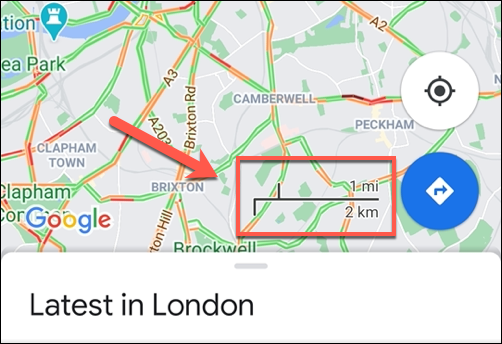
With this setting changed, return to the map view. You should now see the scale appear in the bottom-right without zooming in or out, next to the navigation button.
Zooming in and out of the map will cause the scale to change size, allowing you to view how far (or how close) certain positions are on the map in both miles and kilometers.
Editor's P/S
As a passionate fan of Google Maps, I find the ability to switch between miles and kilometers to be an incredibly useful feature. It allows me to easily view distances and plan routes in the units that I am most familiar with, regardless of where I am in the world.
I also appreciate the fact that Google Maps makes it easy to change the measurement unit on both the desktop and mobile versions of the app. This means that I can always have the information that I need, no matter what device I am using.
Overall, I think that the ability to switch between miles and kilometers is a great example of how Google Maps can be customized to meet the needs of its users. It is a small but significant feature that makes a big difference in the way that I use the app.
